Map: OL30
Unfortunately for Storm, she has come into season and so is unable to go anywhere for three weeks, so once again, I set off by myself. As it happens, we met no-one and no other dogs, so it wouldn't have been a problem, but you can't know that in advance.

Just to show she's not forgotten, even if she couldn't come with me.
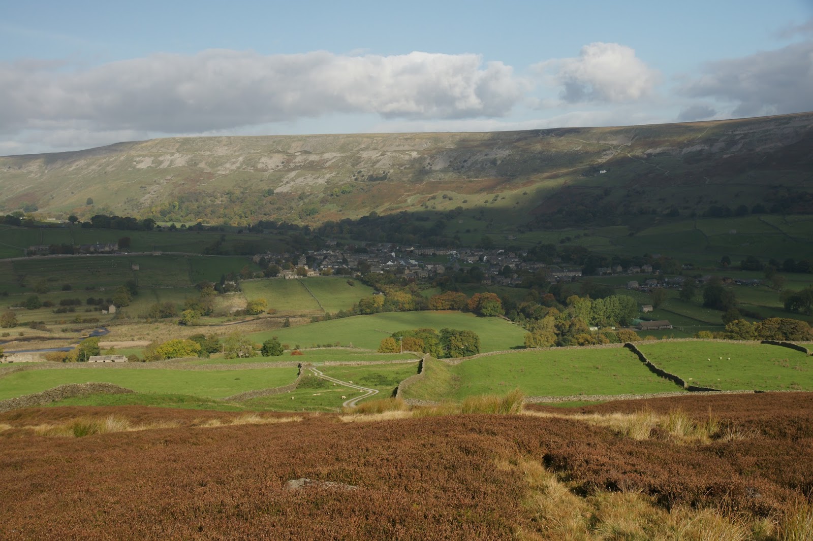
I drove to Grinton; where the road bears right to continue to Reeth, I turned left and headed up towards Grinton Lodge. Once a shooting lodge, it is now a Youth Hostel. Some years ago, the YHA sold off several of their hostels; sadly this wasn't one of them. Had it been, I might well be living in it now!

Just before reaching the hostel,a short distance above Grinton, a road turns to the right, headed towards Redmire. This road is known as the Redmire Moor road and is the road James Herriot was travelling when he got out of his car, lay on the grass verge and decided this was where he wanted to spend the rest of his life. There is a small car park at the junction, so I parked there.

Heading up the road a little way, I found the track (bridleway) running to the right. It might not have been the right path, as there are several up this road and the guide book is not clear as to which one to take.

Anyway, the directions made sense and corresponded with what was happening on the ground. I found the fence mentioned

and then walked down the gully to cross a small stream, then climbed again to reach the fence on the opposite side.


The path passed earth works and Maiden Castle (nothing left but a circle on the ground, which is best seen from above.

I also passed a small pond (very green) and there was a grave next to it - a loved dog perhaps?


After a while, the path vanished entirely, so I climbed to higher ground to see if I could see where the path reappeared. From the height, it was obvious where the path went, so I returned to the lower level and followed a rabbit track across the heather till I rejoined the path.
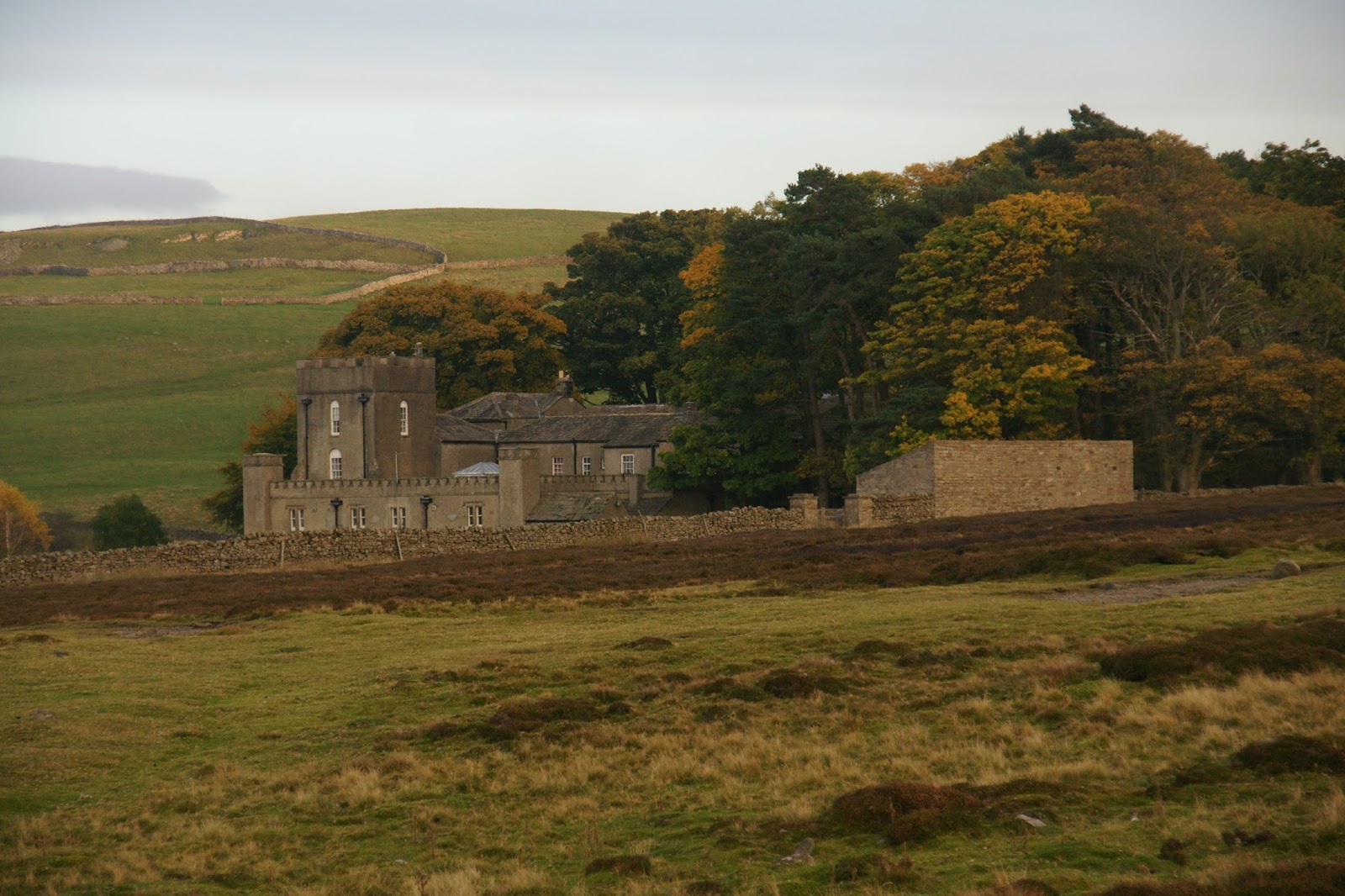
I really liked this composition with the farmhouse, the tree and the hills all around:

I was now much higher and the views all around were amazing - I could see almost the whole of Swaledale in front and behind - well, it felt like that, anyway. Once again, the heather burners were out in force, but thankfully they were far enough away that I only got a whiff occasionally.


Eventually, I came to a junction where I stopped on a suitable rock for some lunch. I had set off about half past eleven and it was now 1.20pm. After lunch, I turned left and headed up hill, eventually joining a wide track. I turned right and shortly came across a hut.

The guide book describes it as a 'large shooting hut'. At this point, I realised a lot can change in 26 years! The guide book was published in 1989 and there were frequent comments about 'sketchy paths', 'grassy tracks' and so on. In fact, the track underfoot was a well maintained gravel path, wide and solid enough for vehicles. However, it deviated somewhat from the path marked by cairns mentioned in the book. I could see the cairns way off to my right and a faint possible path. It seemed sensible to stick to the proper path, so I did, keeping a watch on the original line of the path, just in case it went off at a tangent.
One of the cairns:

You can just make out the original path - a grassy strip wending its way past the cairns:

Another cairn, described in the guide books as 'a conspicuous shapely cairn'. Sadly the path does not pass by it any more, but you can just see it from the track:

There were two grouse butts and a stream that I was supposed to keep on my left, but the new track has them to my right:


The stream bed was dry, as were many of the others I passed. Only one had any water in and that was not running, but lying in the bottom of the bed. We have had a particularly dry October this year.
The track continued to another junction, where a large spoil heap lay at the base of a rather devastated section of land.


The original path went through the devastation (caused by mine workings, long since ceased); the track bypassed the original track, but continued in the same direction. Just before I reached a fence, the track and the original path converged, as indicated by the presence of a large cairn.

Passing through a gate in the fence, I was now at the head of Apedale, with Gibbon Hill to my left. I admit to wondering which came first - the monkey or the ape??


Apedale is lovely! It stretched ahead with little or no sign of human involvement, apart from the ever present smoke on the horizons, the grouse butts that were everywhere, and the track beneath my feet. There was no sound except the wind in my ears and the sound of the grouse (grice? lol) in the heather.
It was a long downhill stretch to Dent's Houses, passing more mine workings. There certainly was a lot of activity in these dales, but now it is silent and nature is reclaiming its territory:


There was a false trail at one point, but there were no houses (there weren't actually any at Dent's either) and the crossroads I was expecting wasn't quite a crossroad. So I ignored it and continued along the path, finally arriving at the real Dent's Houses. There was a barn and a small building that could have been a house at one time I suppose, but neither was inhabited. And there was a proper crossroads.


At this point, I turned left and headed once again up hill to the top of Greets Hill. Having already walked about 8 or 9 miles, uphill was not really welcome.

If I had continued straight ahead, I would have come to the moor road (the Redmire Road, as it happens) and could have followed it downhill, but that would have been 4-5 miles on the road. Instead, I took the left turn and walked over a mile uphill.
Is this the top?

Nope. This one perhaps?

No again, but this is!

I finally arrived at another fence. Once through the fence, this was the last leg of the walk. The path was now just a narrow mown strip in the heather;

shortly afterwards it became a rocky path that was quite hard to walk on,

but soon after that, it turned to a wide grassy path.

I passed yet more mine workings (disused now of course) and headed downhill. The path turned to the right. This then led to the road. An alternative was suggested in the book, to follow an indistinct grassy path straight on (instead of turning right), eventually returning to the path I started on. I chose to take the right turn and quite quickly came to the road. I might have made a different decision had I realised quite how far I was from the junction where I had left my car.

They were still burning the heather on Grinton Moor. Just how do they make it burn in straight lines and, more to the point, how do they manage to make it burn just the section they want and stop it from burning the entire moor?

I walked about 2 miles down the road. Fortunately there is a wide grassy edge to the road, so I wasn't actually walking on the tarcmac. The road was 'busy' - 9 cars, 1 FWD, three white vans, a cyclist and a bus. Technically the bus didn't pass me; it turned round in the mouth of the junction as I approached.
I got back to the car at 5.33pm, so still within daylight and only half an hour later than my estimated time. I had walked about 11 miles. As I arrived, the sun was just sinking below the hills behind me.

Beautiful photos, love the autumn colours! Poor Storm being left at home!
ReplyDeleteShe would have enjoyed it, but we would rather be safe than sorry - don't want some little furry bundles that aren't planned properly. As I said, it actually wouldn't have been a problem - we saw no-one and no dogs, but you can't guess that in advance. If I'd taken her, I'd probably have seen people and dogs at every turn.
DeleteAlso, thank you for the kind comment on the photos.
Delete